Category Archives: Root Cause Analysis – Incident Investigation

Don’t Just Google It . . . Maps Error Leads to Wrong House Being Demolished

By ThinkReliability Staff

Imagine coming “home” and finding an empty lot. That’s what happened in Rowlett, Texas on March 22, 2016. A tornado had previously damaged many of the homes in the area; some were slated for repairs, and some for demolition. The demolition company had plans to level the duplex at 7601 Cousteau Drive, but instead demolished the duplex at 7601 Calypso Drive.

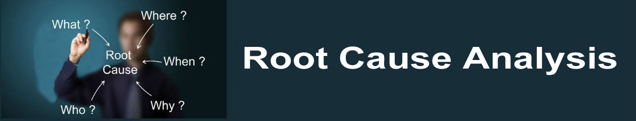
An error on Google Maps has been blamed for the mistake but, as is typical with these types of incidents, there’s more to it than that. To ensure that all the causes leading to an incident are identified and addressed, it’s important to methodically analyze the issue. Creating a Cause Map, a form of root cause analysis that creates a map of cause-and-effect relationships is one way a problem can be analyzed.

The first step in the Cause Mapping process is to capture the what, when and where of an incident. Along with the geographic (where the incident occurred) and process location (what was being done at the time), it can be helpful to capture any differences about the situation surrounding the incident. In this case, “differences” would be anything out of the ordinary during the demolishing of the house at 7601 Cousteau/Calypso. The error on Google Maps (which pointed to the house which was mistakenly demolished) is one difference. Another difference is that the name of the street was not checked during the location confirmation. Other potential differences between this demolish job and other demolish jobs were that the same house number was present on both streets, in close proximity, and both houses experienced tornado damage. These differences may or may not be causally related – at this point, potential differences are just captured.

The next step is to capture the impacts to the organization’s goals as a result of the incident. These impacts to the goals become the first effects in the cause-and-effect relationships. In this case, there’s a potential for injuries (an impact to the safety goal) as a result of an unexpected demolition. The demolition of a house planned to be repaired is an impact to the environmental, customer service, and property goals. The demolition of the wrong house is an impact to the production/ schedule and labor/time goals.

The analysis begins with one of the impacted goals. Asking “why” questions develops cause-and-effect relationships. For example, the demolition of the wrong house was caused by the duplex at 7601 Calypso Drive being demolished while the duplex at 7601 Cousteau was planned for demolition. Because both of these facts (which can be verified with evidence) resulted in the wrong house being demolished, they are both connected to the cause of ‘demolition of wrong house” and joined with an “AND”.

Each cause on the map is also an effect. More detail can be added to the Cause Map by continuing to ask “why” questions. However, one cause may not be sufficient to result in an effect, so questions such as “what else was required?” are also necessary to ensure all causes are present on the map. In this case, the crew went to the wrong house because of an error on Google Maps, which was used to find the house. Per a Google spokeswoman, 7601 Cousteau was shown at the location of 7601 Calypso. This error has been identified as “the cause” of the incident. However, there were other opportunities to catch the error. Opportunities that were missed are also causes in the cause-and-effect relationship. While there was a site confirmation prior to demolition, only the street number (7601), lot location (corner lot), and tornado damage were confirmed. All three of these data points used to confirm the location were the same for 7601 Cousteau and 7601 Calypso.

What hasn’t been mentioned in the news but is apparent from looking at a (corrected) Google Map is that the house-numbering scheme of the neighborhood was set up for failure. 7601 Calypso is on the corner of Calypso Drive and Cousteau Drive, meaning a person could easily believe it was 7601 Cousteau. 7601 Cousteau is just a block away, on the corner of Cousteau Drive and an apparently unnamed alley. I can’t imagine it is the first time that someone has confused the two.

While it’s too late for 7601 Calypso Drive, Google Maps has fixed the error. Likely in the future this demolition company will use another identifier (or will mark the house while talking to the homeowners prior to the demolition) to ensure that the wrong house is not destroyed.

To view the Cause Map, as well as the updated Google Map, click on “download PDF” above.

DC Metro shut down for entire day after fire for inspections

By Kim Smiley 

A fire in a DC Metro tunnel early on March 14, 2016 caused delays on three subway lines and significant disruption to both the morning and evening commutes.  There were no injuries, but the similarities between this incident and the deadly smoke incident on January 12, 2015 (see our previous blog on this incident) led officials to order a 24-hour shutdown of the entire Metro system for inspections and repairs.

The investigation into the Metro fire is still ongoing, but the information that is known can be used to build an initial Cause Map.  A Cause Map is built by asking “why” questions and visually laying out all the causes that contributed to an incident.  Cause Mapping an issue can identify areas where it may be useful to dig into more detail to fully understand a problem and can help develop effective solutions.

So why was there a fire in the Metro tunnel?  Investigators have not released details about the exact cause, but have stated that the fire was caused by issues with a jumper cable.  Jumper cables are used in the Metro system to bridge gaps in the third rail, essentially functioning as extension cords.  The Metro system uses gaps in the third rail to create safer entry and exit spaces for both workers and passengers because of the potential danger of contact with the electrified third rail.  The third rail carries 750 volts of electricity used to power Metro trains and could cause serious injury or even death if accidently touched.

The jumper cables also carry high voltage and fires and/or smoke can occur if one malfunctions.  Investigators have not confirmed the exact issue that lead to this fire, but insulation failures have been identified in other locations and is a possible cause of the fire. (Possible causes can be added to the Cause Map with a “?” to indicate that more evidence is needed.)

One of the things that is always important to consider when investigating an incident is the frequency of occurrence of similar issues.  The scope of the investigation and possible solutions considered will likely be different if it was the 20th time an incident has occurred rather than the first. In this case, the fire was similar to another incident in January 2015 that caused a passenger death.  Having a second incident occur so soon after the first naturally raised questions about whether there were more unidentified issues with jumper cables.  The Metro system uses approximately 600 jumper cables and all were inspected during the day-long shutdown. Twenty-six issues were identified and repaired. Three locations had damage severe enough that Metro would have immediately stopped running trains through them if the extent of the damage had been known.

The General Manger of the DC Metro system, Paul J. Wiedefeld, is relatively new to his position and has been both praised and criticized for the shutdown.  Trying to implement solutions and reduce risk is always a balancing act between costs and benefits.  Was the cost of a full-day shutdown and inspections of all jumper cables worth the benefit of knowing that the cable jumpers have all been inspected and repaired?  At the end of the day, it’s a judgement call, but I personally would be more comfortable riding the Metro with my children now.

For the first time, autonomous car is at fault for a crash

By Kim Smiley

On February 14, 2016, the self-driving Google car was involved in a fender bender with a bus in Mountain View, California.  Both vehicles were moving slowly at the time and the accident resulted in only minor damage and no injuries.  While this accident may not seem like a very big deal, the collision is making headlines because it is the first time one of Google’s self-driving cars has contributed to an accident.  Google’s self-driving cars have been involved in 17 other fender benders, but each of the previous accidents was attributed to the actions of a person, either the drivers of other vehicles or the Google test driver (while they were controlling the Google car).

The accident in question occurred after the Google car found itself in a tricky driving situation while attempting to merge.  The Google car had moved over to the right lane in anticipation of making a right turn.  Sandbags had been stacked around a storm drain, blocking part of the right lane.  The Google car stopped and waited for the lane next to it to clear so that it could drive around the obstacle.  As the Google car moved into the next lane it bumped a bus that was coming up from behind it.  Both the driver of the bus and the Google car assumed that the other vehicle would yield.  The test driver in the Google car did not take control of the vehicle and prevent the car from moving into the lane because he also assumed the bus would slow down and allow the car to merge into traffic. (Click on “Download PDF” to view a Cause Map that visually lays out the causes that contributed to this accident.)

Thankfully, this collision was a relatively minor accident. No one was hurt and there was only relatively minor damage to the vehicles involved. Lessons learned from this accident are already being incorporated to help prevent a similar incident in the future. Google has stated that the software that controls the self-driving cars has been tweaked so that the cars will recognize that buses and other large vehicles may be less likely to yield than other types of vehicles. (I wonder if there is a special taxi tweak in the code?)

It’s also worth noting that one of the driving factors behind the development of autonomous cars is the desire to improve traffic safety and reduce the 1.2 million traffic deaths that occur every year.  The Google car may have contributed to this accident, but Google cars have so far generally proved to be very safe.  Since 2009, Google cars have driven more than 2 million miles and have been involved in fewer than 20 accidents.

One of the more interesting facets of this accident is that it raises hard questions about liability.  Who is responsible when a self-driving car causes a crash? The National Highway Traffic Safety Administration (NHTSA) recently determined that for regulatory purposes, autonomous vehicle software is a “driver” which may mean that auto manufacturers will assume greater legal responsibility for crashes.  NHTSA is working to develop guidance for self-driving vehicles, which they plan to release by July, but nobody really knows yet the impact self-driving cars will have on liability laws and insurance policies.  In addition to the technology issues, there are many legal and policy questions that will need to be answered before self-driving cars can become mainstream technology.

Personally, I am just hoping this technology is commercially available before I reach the age where my kids take away my car keys.

Heavy metal detected in moss in Portland

By Kim Smiley

Residents and officials are struggling to find a path forward after toxic heavy metals were unexpectedly found in samples of moss in Portland, Oregon. According to the U.S. Forest Service, the moss was sampled as part of an exploratory study to measure air pollution in Portland.  The objective of the study was to determine if moss could be used as a “bio-indicator” of hydrocarbons and heavy metals in air in an urban environment.  Researchers were caught off guard when the samples showed hot spots of relatively high heavy metal levels, including chromium, arsenic, and cadmium (which can cause cancer and kidney malfunction).  Portland officials and residents are working to determine the full extent of the problem and how it should be addressed.

So where did the heavy metals come from?  And how is it that officials weren’t already aware of the potential issue of heavy metals in the environment? The investigation into this issue is still ongoing, but an initial Cause Map can be built to document what is known at this time.  A Cause Map is built by asking “why” questions and visually laying out all the causes that contributed to the problem.  (Click on “Download the PDF” to view the initial Cause Map.)

Officials are still working to verify where the heavy metals are coming from, but early speculation is that nearby stained-glass manufacturers are the likely source.  Heavy metals are used during the glass manufacturing process to create colors. For example, cadmium is used to make red, yellow and orange glass and chromium is used to make green and blue glass. The hot spots where heavy metals were detected surround two stained-glass manufacturers, but there are other industrial facilities nearby that may have played a role as well.  There are still a lot of unknowns about the actual emissions emitted from the glass factories because no testing has been done up to this point.  Testing was not required by federal regulations because of the relatively small size of the factories.  If the heavy metals did in fact originate from the glass factories, many hard questions about the adequacy of current emissions regulations and testing requirements will need to be answered.

Part of the difficulty of this issue is understanding exactly what the impacts from the potential exposure to heavy metals might be.  Since the levels of heavy metals detected so far are considered below the threshold of “acute”,  investigators are still working to determine what the potential long-term health impacts might be.

A long-term benefit of this mess is the validation that moss can be used as an indicator of urban air quality.  Moss has been used as an “bio-indicator” for air quality since the 1960s in rural environments, but this the first attempt to sample moss to learn about air quality in an urban setting.  As moss is plentiful and testing it is relatively inexpensive, this technique may dramatically improve testing methods used in urban environments.

Both glass companies have voluntarily suspended working with chromium, cadmium and arsenic in response to a request by the Oregon Department of Environmental Quality.  The DEQ has also begun additional air monitoring and begun sampling soil in the impacted areas to determine the scope of the contamination. As officials gain a better understanding of what is causing the issue and what the long-term impacts are, they will be able to develop solutions to reduce the risk of similar problems occurring in the future.

Crane Collapse In High Winds Kills One in NYC

By ThinkReliability Staff

A crane collapsed in New York City on February 5, 2016 killing one, injuring three, and damaging two city blocks. While an investigation is underway and the causes of the crane collapse have not yet been determined, the city has already implemented new rules to make crane operations safer. We can examine the potential cause-and-effect relationships that led to the issue in a Cause Map, or visual root cause analysis.

We begin by capturing the what, when and where of the incident within a problem outline. The crane collapse occurred February 5 at about 8:30 a.m. Anything that is different or unusual at the time of an incident should also be noted on the outline and an important difference on February 5 was the accelerating winds. The crane that collapsed was a crawler crane, and at the time of the collapse, workers were in the process of securing the crane because of the high winds. This was as expected. Says New York City Mayor Bill de Blasio, “The workers on Friday morning did not begin work on the site, but immediately seeing the winds, made the move to secure the crane, so their timing was appropriate. Upon arrival, they immediately determined the need to secure the crane.”

The impact to the goals as a result of the incident are also captured in the problem outline. In this case, the safety goal was impacted due to the death, as well as injuries. The environmental goal was impacted by water leaks resulting from damage. Customer service (looking at the citizens of New York City as customers) is impacted due to closures. Production is impacted because 418 additional cranes were secured as a result of the incident. Property impacts includes damage to the crane, as well as two city blocks. The labor goal was impacted because of the time required for the response and removal of the damaged crane. It’s also important to capture the frequency of similar events. OSHA reports it has investigated 13 fatal crane accidents in the last 5 years. (There was a crane collapse in New York City in 2008 that resulted in 4 deaths. Click here to see our previous blog on this topic.)

Once the impacts to the goals have been captured, the analysis begins with one of these goals, which is an effect. Asking “why” questions allows the development of cause-and-effect relationships. In this case, the fatality and injuries resulted from the collapse of a crane. It also resulted from people being in the area of the crane collapse. Both of these causes are required (the fatality and injuries would not have occurred if the crane had not collapsed, or if people had not been in the area) so they are listed vertically and joined with “AND”.

People were in the area where the crane collapsed because the area was inadequately secured. This is likely because construction workers were responsible for securing the area, as well as securing the crane. The reasons for the crane collapse are unknown. However, the investigation will look at human error, structural and equipment problems, and impacts from high winds. While the cause has not been determined, it is considered likely that the wind played a role. The crane was not yet secured, as the workers were in the process of attempting to secure it. It was not required to be secured because city regulations limit operation of cranes when wind is above 30 miles per hour(mph), or if there are gusts greater than 40 mph. The crane operators were working under a limit of 25 mph, as sometimes manufacturers use stricter limits. The forecast did not indicate that winds would be greater than 25 mph that day.

As a result of the incident, Mayor de Blasio put into place immediate and temporary rules regarding crane operation. These rules will be in place until a task force provides updated recommendations within 90 days. Uniformed personnel will assist with enforcing closures associated with crane use. Crane operations are limited to wind speeds less than 30 mph (or gusts up to 40 mph). A city sweep and increased fines were also put into place to ensure the updated regulations are followed.

To view a one-page overview of the Outline, Cause Map and interim solutions, click on “Download PDF”.

Avoiding Procedure Horrors in Your Little Shop

By ThinkReliability Staff

Are you singing “Suddenly Seymour”, yet?  In this blog, we take a look at the ever-so-interesting example of a Venus Flytrap.  These fascinating creatures have captured imaginations and inspired many science fiction books, movies and even a musical (Little Shop of Horrors).  When thinking about a Venus Flytrap, the “problem” really depends on the point of view   From the point of view of the fly, the problem is getting eaten for lunch.  From the point of view of the Venus Flytrap, the problem is how to catch its lunch.  Since it’s really only a problem for one of the parties, we will  focus on the question of how, and examine the Process Map as a best practice for documenting the how in your shop.

Process Maps are very useful tools.  Converting a written job procedure or word of mouth instructions into a picture or map can illuminate a complicated process and make it seem quite simple.  Asking how something happens, or how something gets done can provide valuable detail that can be useful for anyone attempting that task now and in the future.  The benefit can include preventing or minimizing incidents that often recur from lack of clarity in a procedure.

To start with, a very simple map can be created that shows the process of a Venus Flytrap eating a fly in 4 steps:  The fly lands in the trap, the trap closes, the plant eats the fly, and the trap opens again.  However, this ‘simple’ process is actually extremely complex.  In his recent article titled “Venus Flytraps Are Even Creepier Than We Thought” (The Atlantic, January 21 , 2016), Ed Yong outlines the process and intricacies of how the carnivorous plant works.  When the fly lands on the Flytrap’s bright red and enticing leaves, a complicated process of chemicals, electrical impulses and physics is kicked off… all with very delicate timing.  The Flytrap’s leaves are covered with sensitive hairs.  If the fly touches those hairs more than once in 20 seconds, it begins a process ensuring its own demise.  A well-timed increase in calcium ions and electrical impulses result in water flowing to the Flytrap’s leaves, causing them to change shape, trapping the fly inside.  At this point, the more the fly struggles, the more problems it creates for itself.  Further stimulating these hairs results in more calcium ions and more electrical impulses, this time resulting in the flow of hormones and digestive enzymes.  Over time, the leaves will create a hermetic seal and fill up with liquid, causing the fly to asphyxiate and die.  Next, the pH level of the fluid inside the trap drops to 2, and the digestive process begins in earnest.  Recent research suggests that chemical sensors on the Flytrap’s leaves can detect the level of digestion of the fly, stimulating the release of more digestive enzymes if needed, or causing the trap leaves to open back up.  The Flytrap is then ready to begin the process again.  As Charles Darwin said, “THIS plant, commonly called Venus’ fly-trap, from the rapidity and force of its movements, is one of the most wonderful in the world.”  (1875. Insectivorous Plants)

This Process Map, while detailed, could surely be broken down into further detail by a entomologist who deeply understands the intricate workings of a Venus Flytrap.  Fortunately for a baby Venus Flytrap, this process map is coded directly into its DNA, so it doesn’t have to rely on anything to know what to do.  Unfortunately for us, work-related tasks are rarely so instinctual.  We rely on job procedures, process maps and word of mouth to learn the best, safest way to get the job done. Ensuring consistency with that transfer of information is key to making sure that incidents and problems are avoided.  Problems that result from poorly defined procedures or work processes can go by many names: procedure not followed, human error, etc.  At the end of the day, the roots (pun intended) of many of these problems are poorly articulated or poorly communicated work processes.  The simple tool of a process map can help minimize these problems by making the steps of the process clear and easy to understand.

Investigators Blame “Human Error” for Train Collision

By Kim Smiley

On February 9, 2016, two commuter trains collided head-on in Upper Bavaria, Germany.  Eleven people were killed and dozens were injured.  Investigators are still working to determine exactly what caused the accident and the train dispatcher is currently under investigation for involuntary manslaughter and could face up to five years in prison if convicted.

Although the investigation is still ongoing, some information has been released about what caused the crash.  The two trains collided head-on because they were both traveling on the same track toward each other in opposite directions.  Running two trains on the same track is common practice in rural regions in Germany and these two trains were scheduled to pass each other at a station with a divided track. The drivers of both trains were unaware of the other train.  The accident occurred on a bend in a wooded area so the drivers could not see the other train until it was too late to prevent the collision.

The dispatcher failed to prevent a situation where two trains were running towards each other on the same track or to inform the drivers about the potential for a collision.  Investigators have stated that the dispatcher sent an incorrect signal to one of the trains due to “human error”.  After realizing the mistake – and that a collision was imminent – the dispatcher issued emergency signals to the trains, but they were too late to prevent the accident.

All rail routes in Germany have automatic braking systems that are intended to stop a train before a collision can occur, but initial reports are that the safety system had been manually turned off by the dispatcher.  German media has reported that the system was overridden to allow the eastbound train to pass because it was running late, but this information has not been confirmed.  Black boxes from both trains have been collected and analyzed.  Technical failure of the trains and signaling equipment have been ruled out as potential causes of the accident.

The information that has been released to the media can be used to build an initial Cause Map, a visual root cause analysis, of this issue.  A Cause Map visually lays out the cause-and-effect relationships and aids in understanding the many causes that contributed to an issue. The Cause Map is built by asking “why” questions. A detailed Cause Map can aid in the development of more effective solutions.

One of the general Cause Mapping rules of thumb is that an investigation should not stop at “human error”.  Human error is too general and vague to be helpful in developing effective solutions. It is important to ask “why” the error was made and really work to understand what factors lead to the mistake.  Should the safety system be able to be manually overridden?  Is the training for dispatchers adequate?  Does there need to be a second check on decisions by dispatchers?  Should two trains traveling in opposite directions be sharing tracks?  I don’t know the answers, but these questions should be asked during the investigation.  Charging the dispatcher with involuntary manslaughter may prevent HIM from making the same mistake again, but it won’t necessarily reduce the risk of a similar accident occurring again in the future.  To really reduce risk, investigators need to dig into the details of why the error was made.

Failure of the Nipigon River Bridge

By Kim Smiley

On the afternoon of January 10, 2016, the deck of the Nipigon River Bridge in Ontario unexpectedly shifted up about 2 feet, closing the bridge to all vehicle traffic for about a day.  After an inspection by government officials and the addition of 100 large cement blocks to lower the bridge deck, one lane was reopened to traffic, with the exception of oversized trucks. Heavier trucks are required to detour around the bridge with the main alternative route requiring crossing into the United States.  This failure is still being investigated and it isn’t known yet when it will be safe to open all lanes on the bridge.

More information is needed to understand all the details that led to this failure, but an initial Cause Map, a visual root cause analysis, can be built to illustrate what is currently known. The first step in the Cause Mapping process is to fill in the Outline to document the basic background information (the what, when and where) and the impacts to the organization’s goals resulting from the issue.  For this example, the bridge was damaged and significant resources will be needed to investigate the failure and repair the bridge.  The closure of the bridge, and subsequently having only a single open lane, is also having a sizable impact on transportation of both people and goods in the area.  It is estimated that about $100 million worth of goods are moved over the bridge daily and there are limited alternative routes.

Once the Outline is completed, the Cause Map is built by asking “why” questions and visually laying out the cause-and-effect relationships.  Why did the deck of the bridge shift up?  Investigators still don’t have the whole answer. The Nipigon River Bridge is a cable stayed bridge and bolts holding the bridge cables failed, resulting in the deck of the bridge being pulled up at an expansion joint.  Two independent testing facilities, National Research Council of Canada in Ottawa and Surface Science Western at Western University, are conducting tests to determine the cause of the bolt failures, but no information has been released at this time.

The Nipigon River Bridge is a new bridge that has only been open since November 29, 2015. Some hard questions about the adequacy of the bridge design have been asked because the failure occurred so soon after construction.  Officials have stated that the bridge design meets all applicable standards, but investigators will review the design and structure during the investigation to ensure it is safe.  Ontario winters can be harsh and investigators are going to look into whether cold temperatures and/or wind played a role in the failure.  Eyewitnesses have reported a large gust of wind just prior to the bolt failure.  Investigators will determine what role the wind played.

The Cause Map can easily be expanded to incorporate new information as it becomes available. Once the Cause Map is completed, the final step in the Cause Mapping process is to develop solutions to prevent a similar problem from recurring.  In this example, adding the concrete blocks as counter weights allowed one lane of the bridge to be opened in the short term, but clearly a longer-term solution will be needed to repair the bridge and ensure a similar failure does not occur again.

Is Having a Lockout/ Tagout (LOTO) Procedure Enough?

By Staff

The number of possible types of injuries occurring when performing work on energized equipment is impossible to count.  They can range from burns, to electrical shock, to crush injuries, to cuts/lacerations, and beyond.  In an effort to help eliminate some of these injuries, the OSHA standard for Control of Hazardous Energy (29 CFR 1910.147), more commonly known as lockout/tagout (LOTO), went into effect in 1989.  The purpose of the standard is to help companies establish the practices and procedures needed to prevent injury to workers when they are performing maintenance activities to equipment requiring an energy source.  Any company in violation of the standard is subject to a fine.  It is estimated that in 2013, there were approximately $14 million in federal and state fines, and lockout/tagout was the 5th most frequently violated standard in 2015.

However, the REAL goal of the standard is to keep people safe.  So how is the standard violated?  It can happen in many ways, but this blog takes a look at one specific incident to better understand  how it can happen.  This analysis is based on a case study presented in the article “Lockout/Tagout Accident Investigation” from the August 2014 issue of Occupational Health & Safety.

In this incident, several contractors were working on a project involving a particular switchgear.  Many of these contractors had performed lockout/tagout for the switchgear box related to the projects that they were working on.  After the work began, a worker from a different contractor was asked to clean out part of the switchgear.  Unfortunately, an arc flash occurred when he reached in the switchgear, resulting in burns to his hand and a blow-out injury to his knee.  Fortunately, the employee survived, recovered, and was able to return to his normal life.

A Cause Map can be built to analyze this issue.  The first step in Cause Mapping is to determine how the incident impacted the overall goals.  For this incident, the safety goal was the most obviously impacted goal due to the injuries that the worker sustained.  The goal is always for employees to leave the workplace in the same health in which they arrived.  Additionally, the regulatory goal was impacted since the injuries were severe enough that they were classified as recordable.

The Cause Map is a visual representation of the cause-and-effect relationships that contributed to the incident.  Starting with the impacted safety goal, ‘why’ questions can be asked to identify the key factors that caused the problem.  In this case, the injuries were caused by the fact that an arc flash occurred when the worker reached into the switchgear and he was not wearing personal protective equipment.  The worker was probably not wearing PPE because he thought that the switchgear was de-energized, and this was an effect of the fact that there were locks and tags already on the switchgear.  The arc flash was a result of the fact that the circuit breaker was energized when the worker reached in to clean it.  The circuit breaker was energized because of three factors: a different contractor had put it back in service the night before, the circuit was not tested by the worker, and the worker didn’t do his own lockout procedure.  Each of these problems can be further analyzed to reveal problems with communication, adding the task at the last minute and not including every task in a job safety analysis.

For this situation, and many like it, eliminating a cause anywhere on the map could have minimized the risk of the incident occurring.  For example, had the worker taken the time to put on protective equipment or test the circuit breaker, he might not have been injured.  Similarly, had the other contractors taken the time to update their locks/tags and ensure that they had communicated that the circuit had been reenergized to all interested parties, the worker might not have been injured.  This example demonstrates that having a lockout/tagout procedure is the first step in avoiding injuries.  Ensuring that the procedure is followed in combination with other safety standards is also important to minimize the risk of injury.

Landslide of construction debris buries town, kills dozens

By ThinkReliability Staff

Shenzhen, China has been growing fast. After a dump site closed in 2013, construction debris from the rapid expansion was being dumped everywhere. In an effort to contain the waste, a former rock quarry was converted to a dump site. Waste at the site reached 100 meters high, despite environmental assessments warning about the potential for erosion. On December 20, 2015, the worries of residents, construction workers and truckers came true when the debris slipped from the quarry, covering 380,000 square meters (or about 60 football fields) with thick soil as much as 4 stories high.

A Cause Map can be built to analyze this issue. One of the steps in the Cause Mapping process is to determine how the issue impacted the overall goals. In this case, the landslide severely impacted multiple goals. Primarily, the safety goal was impacted due to a significant number of deaths. 58 have been confirmed dead, and at least 25 are missing. The environmental goal and customer service goal were impacted due to the significant area covered by construction waste. The regulatory goal is impacted because 11 have been detained as part of an ongoing criminal investigation. The property goal is impacted by the 33 buildings that were destroyed. The labor goal is also impacted, as are more than 10,600 people participating in the rescue effort.

The Cause Map is built by visually laying out the cause-and-effect relationships that contributed to the landslide. Beginning with the impacted goals and asking “Why” questions develops the cause-and-effect relationships. The deaths and missing persons resulted from being buried in construction waste. Additionally, the confusion over the number of missing results from the many unregistered migrants in the rapidly growing area. The area was buried in construction waste when waste spread over a significant area, due to the landslide.

The landslide resulted from soil and debris that was piled 100 meters high, and unstable ground in a quarry. The quarry was repurposed as a waste dump in order to corral waste, which had previously been dumped anywhere after the closure of another dump. Waste and debris was piled so high because of the significant construction debris in the area. There was heavy construction in the area because of the rapid growth, resulting in a lot of debris. Incentives (dumpsite operators make money on each load dumped) encourage a high amount of waste dumping. Illegal dumping also adds to the total.

While an environmental impact report warned of potential erosion, and the workers and truck drivers at the dump registered concerns about the volume of waste, these warnings weren’t heeded. Experts point to multiple recent industrial accidents in China (such as the warehouse fire/ explosion in Tianjin in August, the subject of a previous blog) as evidence of the generally lax enforcement of regulations. Heavy rains contributed to ground instability, as did the height of the debris, and the use of the site as a quarry prior to being a waste dump.

Actions taken in other cities in similar circumstances include charging more for dumping debris in an effort to encourage the reuse of materials and monitoring dump trucks with GPS to minimize illegal dumping. These actions weren’t implemented in Shenzhen prior to the landslide, but this accident may prompt their implementation in the future. Before any of that can happen, Shenzhen has a long way to go cleaning up the construction debris covering the city.